Bird’s Eye View is a full service GIS shop located in Albuquerque, New Mexico. We serve conservation and community organizations worldwide.

We help people communicate their ideas and data with engaging and powerful maps, offering  everything from basic cartography to web based applications.

Twitter Feed
Monday
Jan022017

The Concise 2016 Year in Review...Another Good Year!

Professionally 
  • ~ 400 maps made...roughly
  • Numerous analyses done, some big, some small
  • Worked for 21 clients
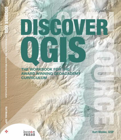
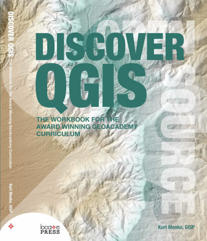
  • Authored Discover QGIS with Locate Press
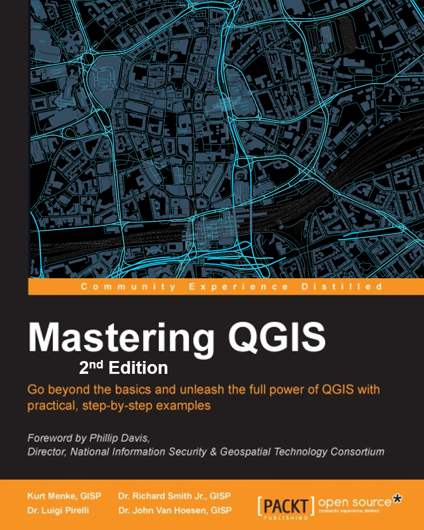
  • Co-authored Mastering QGIS Second Edition with Packt Publishing
  • Began learning R & working with GeoPackages, getting better at PostGIS/SpatiaLite and brushing up on Python
  • Continued to migrate all GIS work to FOSS4G
  • Connected with a lot of great geospatialists via social networking
  • Taught Community Health Map workshops in: 
    • Seattle WA (twice)
    • Honolulu HI
    • Spokane WA
    • Bethesda MD (twice)
  • Gave talks at:
  • Authored 17 Community Health Mapping blog entries
  • Taught 8 GIS courses at UNM Continuing Education
  • Travelled to: 
    • Seattle (twice)
    • Lawrence KS
    • Raliegh
    • New York City
    • Washington DC
    • Orlando FL
    • Bisbee AZ
    • Spokane WA
    • Honolulu
    • Meeker CO
    • Denver (twice)
    • Red River NM
Personally
  • Worked out 205 times...20 more than last year!
  • Climbed my 21st fourteener (Mt Bierstadt)...a work in progress
  • PR dead lift – 305lb – 8x
  • PR back squat – 275lb – 4x
  • Walked 410 miles...ah technology!
Tuesday
Oct112016

What's New in Mastering QGIS - 2nd Edition? 

Myself, Rick Smith, Luigi Pirelli and John Van Hoesen are excited to announce the expanded second edition of Mastering QGIS. The goal of this book is to help intermediate and advanced users of GIS develop a deep understanding of the capabilities of QGIS while building the technical skills that would facilitate in making the shift from a proprietary GIS software package to QGIS. It is available in both hard copy and digital versions from Packt Publishing and Amazon.
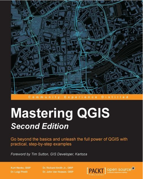
The book, which begins with a Foreword by Tim Sutton (QGIS Project Chairman), adds one new chapter, and 70 new pages from the first edition. Many new features have arisen in the last year. This book covers them all with step by step examples. This edition is updated to the latest long-term release version (2.14), and includes descriptions and examples of many new features. For example, this includes a new chapter on Advanced Data Visualization which covers live layer effects, QGIS2ThreeJS and Atlas generation. 

What the book covers:

Chapter 1, A Refreshing Look at QGIS, reviews installation and basic functionality of QGIS that are assumed knowledge for the remainder of the book. New material includes user interface themes and working with Custom QGIS variables.  

Chapter 2, Creating Spatial Databases, covers how to create and edit spatial databases using QGIS. While QGIS supports many spatial databases, SpatiaLite will be used in this chapter. First, core database concepts will be covered, followed by the creation of a spatial database. Next, importing, exporting as well as editing data will be covered. The chapter concludes with queries and view creation.

Chapter 3, Styling Raster and Vector Data, covers styling raster and vector data for display. First, color selection and color ramp management are covered. Next, single-band and multi-band raster data are styled using custom color ramps and blending modes. Next, complex vector styles and vector layer rendering are covered. Rounding out the chapter is the use of diagrams to display thematic map data. New material includes the numerous updates to the data Styling interface and all the new renderers (2.5D, heatmap, point displacement, inverted polygon & GRASS edit). 

Chapter 4, Preparing Vector Data for Processing, covers techniques useful for turning raw vector data into a more usable form. The chapter starts with data massaging and modification techniques such as merging, creating indices, checking for geometry errors, and basic geoprocessing tools. Next, advanced field calculations are covered, followed by complex spatial and aspatial queries. The chapter ends by defining new or editing existing coordinate reference systems. New material includes: new geometry checker tools and conditional formatting for attribute table cells.

Chapter 5, Preparing Raster Data for Processing, covers the preparation of raster data for further processing using the GDAL menu tools and the Processing Toolbox algorithms. Specifically, these include reclassification, resampling, rescaling, mosaics, generating pyramids, and interpolation. The chapter concludes with raster and vector data model coversions. New material includes the Slicer plugin and the new raster alignment tool. 

Chapter 6, Advanced Data Creation and Editing, provides advanced ways to create vector data. As there is a great deal of data in tabular format, this chapter will cover mapping coordinates and addresses from tables. Next, georeferencing of imagery into a target coordinate reference system will be covered. The final portion of the chapter will cover testing topological relationships in vector data and correcting any errors via topological editing.

Chapter 7, Advanced Data Visualization is a brand new chapter! In it we provide advanced ways to display your analysis results. QGIS has a greatly expanded repertoire of layer styling and display options. In this chapter, you will learn how to use Live Layer Effects, utilize the inverted polygon and 2.5D renderers, create an Atlas in the Print Composer and use the QGIS2ThreeJS plugin to create a 3D view of your data.

Chapter 8, Exploring the Processing Toolbox, begins with an explanation and exploration of the QGIS Processing Toolbox. Various algorithms and tools, available in the toolbox, will be used to complete common spatial analyses and geoprocessing tasks for both raster and vector formats. To illustrate how these processing tools might be applied to real-world questions, two hypothetical scenarios are illustrated by relying heavily on GRASS and SAGA tools. New material includes working with R tools and Lidar data with LASTools. 

Chapter 9, Automating Workflows with the Graphical Modeler, covers purpose and use of the graphical modeler to automate analysis workflows. In the chapter, you will develop an automated tool/model that can be added to the Processing Toolbox.

Chapter 10, Creating Plugins for PyQGIS Problem Solving, covers the foundational information to create a Python plugin for QGIS. Information about the API and PyQGIS help will be covered first, followed by an introduction to the iface and QGis classes. Next, the steps required to create and structure a plugin will be covered. The chapter will be wrapped up after providing you with information on creating graphical user interfaces and setting up debugging environments to debug code easily.

Chapter 11, Python Analysis Scripting with QGIS, provides topics for integrating Python analysis scripts with QGIS outside of the Processing Toolbox. Layer loading and management are first covered, followed by an exploration of the vector data structure. Next, programmatic launching of other tools and external programs are covered. Lastly, the QGIS map canvas is covered with respect to how a script can interact with the map canvas and layers within.



Thursday
Jul282016

Discover QGIS Is Out in Print!

I'm excited to announce my latest QGIS book! Called Discover QGIS, it is the workbook for the award winning GeoAcademy curriculum. It is essentially 5 college courses full of labs! It comes with all the data, challenge exercises and solution files. Great for learning GIS, QGIS or for use in the classroom.

The GeoAcademy is the first ever GIS curriculum based on a national standard—the U.S. Department of Labor’s Geospatial Competency Model—a hierarchical model of the knowledge, skills, and abilities needed to work as a GIS professional in today’s marketplace.

Originally written for QGIS v2.4, the GeoAcademy material in this workbook has been updated for use with QGIS v2.14, Inkscape v0.91, and GRASS GIS v7.0.3. This is the most up-to-date version of the GeoAcademy curriculum. To aid in learning, all exercise data includes solution files.


Saturday
May142016

Thoughts on FOSS4GNA 2016

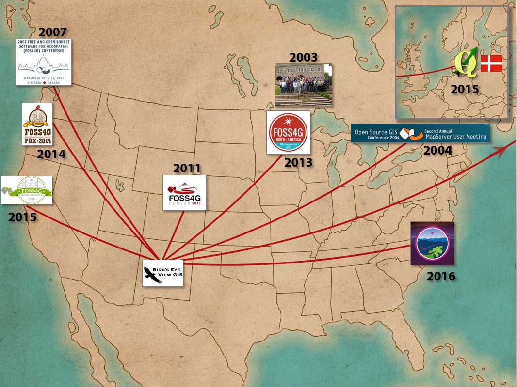
FOSS4G has been my favorite conference since I attended the first Mapserver meeting in 2003. I've attended each North American installment since then...except for the 2012 NA meeting in DC. I shared about this in my talk Adventures of a Solo GIS Consultant. (The map for my talk is below)

The 2016 edition FOSS4GNA did not dissapoint. In fact it was one of the best, and not because I fell in love with Raleigh the way I did with Victoria in 2007, or Portland in 2014. Raleigh was nice, but it was more about the conversations between the talks. I loved that the organizers gave us so many long breaks. The rain all week also helped keep me inside :)

Perhaps it is because I work for myself that being around all these like minded folks is so stimulating. Perhaps it's because I get to meet people I know from Twitter, face-to-face. I loved the moments when I was standing in a group of people and we're all introducing ourselves, by our Twitter handles, like "I'm @spara." Perhaps it's being around some of the smartest people I know. I know it's a little of all of these. FOSS4G is more than the sum of it's parts. I always learn new things, but if that is all it was, I wouldn't keep going back. It's because there is a community of people behind the twitter handles. OsGeo has done a great job of fostering a community with these conferences.

I met a lot of people I knew from social networking like @sarasomewhere, fellow Locate Press author @PetersonGIS, #gistribe members @gisn8, @UUDreams, @MicheleTobias & @spara. I made some new friends too, like @GuidoS & @TinaACormier, and it is always nice to be able to catch up with people like @rjhale.

The workshops on Monday were great. I attended the GDAL/OGR workshop taught by Sara Safavi & Sasha Hart and the Getting the most out of QGIS with Python by Chris Daley. Each had a good mix of review and new material. 

The BoF sessions were a highlight. I sat in on QGIS, #gistribe and Women in GIS. The latter was a great discussion and I really appreciated hearing the experiences women have at FOSS4G and in the workplace. I've seen the numbers of women increasing over the years at FOSS4G, but it was good to hear how it could be more inclusive.

Of course there were many great talks. Some of my highlights were:

  • State of the QGIS Project by Larry Shaffer
  • Awaken the QGIS Within by Gretchen Peterson
  • Uncovering Ancient Mound Builders Using Open Data and FOSS Software by Calvin Hamilton
  • Cartography with Inkscape by Michele Tobias
  • WTFGL: a beginner's guide to the future of open source web mapping by Lyzi Diamond
  • Empirical Mining of Large Data Sets Help to Solve Practical Large-Scale Forest Management and Monitoring Problems by Bill Hargrove

I also greatly underestimated the keynote addresses. Each day I'd look at the title and say, "Maybe I can skip this and sleep in, or go get a good breakfast." But I ended up attending each one, and they were all fascinating. Each a little out of the box and provacative in just the right way.

Thanks to the organizing committee for putting together a great conference. I thought the venue, the session schedule, the food and the communication were all outstanding. 

FOSS4GNA Raleigh Organizing Committee

I wish I had the budget to go to the 2nd QGIS meeting in Gerona or FOSS4G in Bonn. Realistically though the next time I'll be able to add to my map is FOSS4G in Boston in 2017. So hopefully I'll see you there!

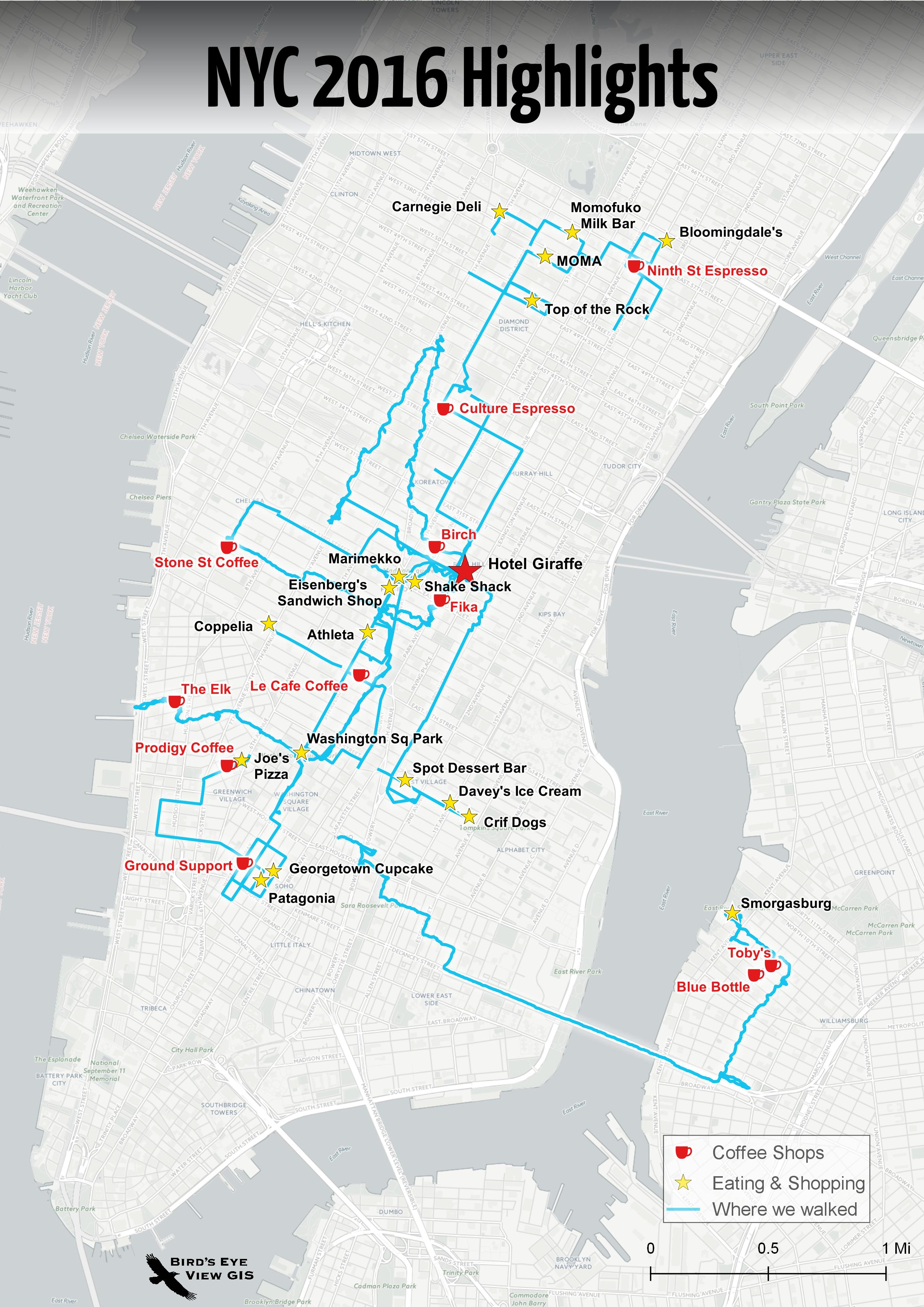
PS...after FOSS4GNA I met my wife in NYC to celebrate my birthday. NYC didn't dissappoint. The map of our adventures is below!


Sunday
May012016

2016 Brings Two New QGIS Books!

It's been such a busy year I haven't even had time to blog. Now that I'm sitting in my hotel room in Raleigh settling in for another FOSS4G, I finally have a bit of time. I've been doing a lot of GIS analysis, cartography, teaching, travelling to teach workshops, and blogging at Community Health Maps. I have also been working on the second edtion of Mastering QGIS and a brand new book Discover QGIS. Both books should be out in the next couple weeks!

Mastering QGIS - 2nd Edition will be an updated version of last years book. All the material is being updated to the latest long-term release of QGIS v2.14. It wil also feature a new chapter on Advanced Data Visualization. This new chaptter will cover use of Live Layer Effects, 3d mapping with the 2.5D renderer and the QGIS2ThreeJS plugin, use cases for inverted polygon shapeburst fills, and atlas generation.

Wiith Discover QGIS, the award winning GeoAcademy curriculum will be available in a workbook format. The material has been updated for use with QGIS 2.14, Inkscape 0.91, and GRASS GIS 7.0.3. The material is also backwards compatible to QGIS v2.8 despite minor GUI changes. It therefore represents the most up-to-date version of the GeoAcademy curriculum. It will be released in the coming weeks. It will include full solution files and a forward by Dr. Phil Davis. 

Look for both offerings soon!


Thursday
Dec312015

The Concise 2015 Year in Review...A Good Year!

Professionally

Personally

  • Celebrated my grandmothers 100th birthday
  • Travelled to Denmark, Vermont, New York City, San Francisco, Colorado, Bisbee AZ and Charleston SC.
  • Worked out 184 times...not bad for an aging GeoHipster!
  • Walked 370 miles...ah technology!
  • Climbed my 20th 14’er (Mt Yale)...a work in progress
  • PR bench press – 215lb 3x
  • PR dead lift – 300lb – 5x
  • PR back squat – 205lb – 4x