Bird’s Eye View is a full service GIS shop located in Albuquerque, New Mexico. We serve conservation and community organizations worldwide.

We help people communicate their ideas and data with engaging and powerful maps, offering  everything from basic cartography to web based applications.

Twitter Feed

Entries from March 1, 2015 - March 31, 2015

Tuesday
Mar312015

Mastering QGIS is Ready for your Bookshelves!

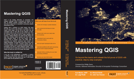
It is with great excitement and pride that I announce our book Mastering QGIS has been published! I co-authored this book with Dr. Richard Smth, Dr. Luigi Pirelli and Dr. John Van Hoesen. It is available as both an eBook and in hard copy from Packt Publishing and Amazon.

Mastering QGIS Cover

QGIS is the leading alternative to proprietary GIS software. Although QGIS is described as intuitive, it is also, by default, complex. Knowing which tools to use and how to apply them is essential to producing valuable deliverables on time.

Starting with a refresher on QGIS basics, this book will take you all the way through to creating your first custom QGIS plugin. By the end of the book you will understand how to work with all the aspects of QGIS, and will be ready to use it for any type of GIS work.

The introductory section servers as a quick start guide for those with little QGIS experience. It includes directions for installing QGIS on all the major platforms, reviews the layout of QGIS Desktop and Browser, and covers adding data, working with projections, querying tables, creating maps and finding and installing plugins.

From the refresher, you will learn how to create, populate and manage a spatial database and walk through styling GIS data, from creating custom symbols and color ramps, to using blending modes. In the next section, you will discover how to prepare vector and raster data for processing and discover advanced data creation and editing techniques, such as geocoding, georeferencing and topological editing. The last third of the book covers more technical aspects of QGIS, including working with the Processing Toolbox, how to automate workflows with batch processing, and how to create graphical models. Finally, you learn how to create and run Python data processing scripts and write your own QGIS Plugin with pyqgis.

This book is the most thorough tutorial for everyone needing a free and open source desktop GIS.

Saturday
Mar142015

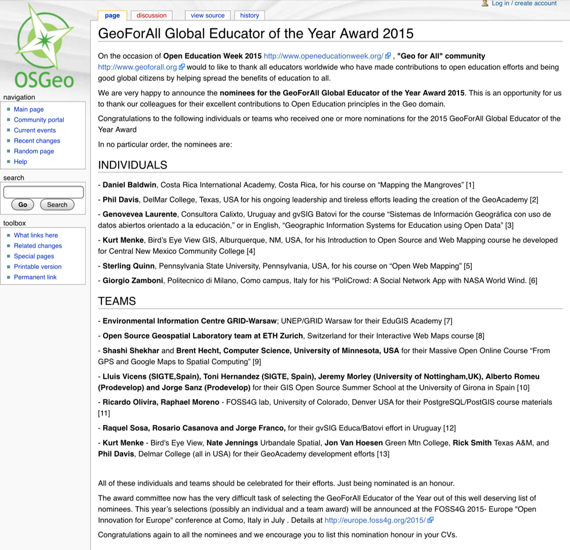
Geo For All Announces Nominations for Global Educator of the Year! 

As a part-time educator it is exciting to be nominated for the Geo For All Global Educator of the Year Award! I've been passionate about promoting FOSS4G for many years and am excited to see it gaining more traction in eductional programs. I was fortunate to be nominated for a course I developed, and have been teaching for the last 6 years, at Central New Mexico Community College. I have also been part of the GeoAcademy team. I developed 3 of the 5 courses and have been teaching them on line through Del Mar College. Our team was nominated for that work as well. As we say everyone can 'Steal this curriculum for Free'! https://foss4geo.wordpress.com/


Saturday
Mar072015

Announcement: Learn the new QGIS 2.8.1!

The GeoAcademy is pleased to announce the launch of their new Introduction to Geospatial Technology Curriculum. The curriculum will be based on the latest version of QGIS, version 2.8.1 Wien which is a long term release (LTR).

The curriculum is a complete package of five GIS courses leading to a Certificate of Proficiency in QGIS from the Del Mar College continuing education program. The five courses will be offered in a limited-enrollment online class format (25 students maximum), taught by leading GIS professional educators (GISP & PhD) who created the course material. I am one of the instructors.

The first course, GST 101—Introduction to Geospatial Technology Using QGIS 2.8.1 will begin April 3, 2015 to be followed each month by a new course through August 2015. Tuition is $25 USD per course, or a total of $125 for all five in the Certificate of Proficiency. The courses include:

  1. GST 101—Introduction to Geospatial Technology Using QGIS 2.8.1 (April 2015)
  2. GST 102—Spatial Analysis Using QGIS 2.8.1 (May 2015)
  3. GST 103—Data Acquisition & Management Using QGIS 2.8.1 (June 2015)
  4. GST 104—Cartography Using QGIS 2.8.1 (July 2015)
  5. GST 105—Remote Sensing Using QGIS 2.8.1 and GRASS 7.0 (August 2015)

Anyone interested in learning more about the offer or enrolling should contact the GeoAcademy director: Phillip Davis at (361) 698-1476 or email:pdavis@delmar.edu

Saturday
Mar072015

Mastering QGIS Due out by the end of the month!

Over the winter Kurt Menke co-authored Mastering QGIS along with Dr. Richard Smith, Dr. John Van Hoesen and Dr. Luigi Pirelli. The book will allow you to go beyond the basics and unleash the full power of QGIS with the help of practical, step-by-step examples. Topics covered in the book include: working with spatial databases, advanced vector and raster data processing, styling data, working with the processing toolbox, building models with the graphical modeler, automating processes with scripting and building Python plugins. 

The book is due out by the end of March. It will be available in both e-book and hard copy formats. Pre-orders are being accepted now! Visit the books page on the Packt Publishing site for more details.


Mastering QGIS cover

Saturday
Mar072015

QGIS 2.8.1 Released

This week the next stable version of QGIS was released. It is being called QGIS version 2.8 ‘Wien‘. Wien is German for ‘Vienna‘ which was the host city for the QGIS developer meetings in 2009 and 2014.

QGIS 2.8 Splash Page

Recently a new version of QGIS has been released every four months. This rapid pace of development has its pros and cons. On the plus side, the software is rapidly growing and improving. On the con side it has made it difficult to maintain documentation. It has also been an issue for people working on large projects. They have had to deal with the software changing every four months.

QGIS 2.8 is a special release because it is the first in a series of long-term releases (LTR’s). The idea is that one release per year will be an LTR. This means that the LTR release will be supported and available for download for one year. This way people needing stability can use this until the next LTR is released a year from now.

Some of the highlights are:

  • Numerous bug fixes and stability improvements
  • QGIS Browser is more responsive
  • Ability to select the units in the Measure tool
  • Improvements to editing: better control of snapping and a new suite of Advanced Digitizing tools
  • Improvements to the Map Composer such as better control over coordinate graticules and map rotation.
  • Symbology improvements such as filling polygons with raster images, ability to have multiple styles per layer.

The detailed list of new features can be found in the QGIS Virtual Change log: http://www2.qgis.org/en/site/forusers/visualchangelog28/index.html

Visit the download page and take the new version for a spin. Remember you can install it on Windows, Mac and Linux!

Saturday
Mar072015

Bird's Eye View Conducts a Training in the South Carolina Lowcountry

Recently Kurt Menke headed to Charleston, South Carolina to train several groups how to map their communities. This was part of the Community Health Maps project with the National Library of Medicine. This region is also known as the ‘lowcountry’ due to the flat, low elevation geography. The training was hosted by the Medical University of South Carolina (MUSC) and included people from Communities in Schools – Charleston (CISC) and the MUSC School of Nursing.

MUSC Community Health Mapping Training at the School of Nursing

First everyone learned how collect GPS field data with iPads. For this we used a new app named iForm. This app was used in lieu of EPI Collect, which no longer supported on iOS.  iForm is an app very similar to the Android app ODK Collect, allowing a custom data collection form to be developed. To practice we collected bike rack locations  and seating areas around the MUSC campus. The afternoon was spent working with everyone’s  data. GPS data points were brought into QGIS and shown against some local Charleston GIS data layers.

 
MUSC Data Points in QGIS

The points were also uploaded to CartoDB. CartoDB is another new component of the Community Health Mapping workflow. It has become more intuitive than GIS Cloud and worked really well. (Note: There will be a post on using CartoDB soon too.)

The following day I visited CISC’s Derek Toth and three of his students at St. John’s High School on John’s Island, SC. Over a working lunch Mr. Toth showed students how easy it is to collect GPS points with their iPhones. We collecting several points while walking around the campus.

 
Mapping the St. Johns Campus

Afterwards we went back inside and showed them how to upload the points into CartoDB and make a map. The figure below shows the results of 45 minutes worth of work! Click on the map to open the live version.

 St Johns High School Data Points in CartoDB

This spring these three juniors will be leading the charge to map their island!  They will be presenting their work to the National Library of Medicine later this spring. I look forward to seeing their work!

The St. Johns High School Mapping Team from left to right: Jocelyn Basturto, Khatana Simmons, Candace Moorer (MUSC), Corrieonna Roper & Derek Toth (CISC)